
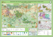
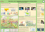
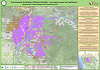
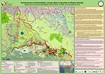
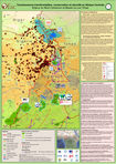
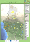
Interactive maps
These must be opened in an Adobe Reader to ensure the interactivity of the buttons.
| Administrative Area | Documents | Administrative Areae | Documents |
|---|---|---|---|
| Congo Basin | Interactive map | Tchad | Interactive map |
| Burundi | Interactive map | Rwanda | Interactive map |
| Cameroun | Interactive map | République Démocratique du Congo | Interactive map |
| République du Congo | Interactive map | République Centrafricaine | Interactive map |
| Gabon | Interactive map | Guinée Équatoriale | Interactive map |
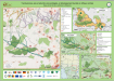
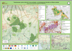
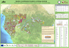
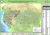
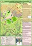
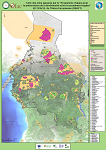
Interactive maps of protected areas
These must be opened in an Adobe Reader to ensure the interactivity of the buttons.
- Andre Felix: Interactive map
- Bamingui-Bangoran: Interactive map
- Benoue: Interactive map
- Binder-Lere: Interactive map
- Biringou: Interactive map
- Bouba Ndjida: Interactive map
- Boumba Bek: Interactive map
- Campo Maan: Interactive map
- Conkouati - Douli: Interactive map
- Corisco y Elobeyes: Interactive map
- Dimonika: Interactive map
- Dja: Interactive map
- Fada Archei: Interactive map
- Faro: Interactive map
- Foret de Deng-Deng: Interactive map
- Garamba: Interactive map
- Ivindo: Interactive map
- Kahuzi-Biega: Interactive map
- Kalamaloue: Interactive map
- Korup: Interactive map
- Kundelungu: Interactive map
- La Caldera de Luba: Interactive map
- Lac Tele: Interactive map
- Lefini: Interactive map
- Lessio-Louna: Interactive map
- Loango: Interactive map
- Lobeke: Interactive map
- Lomako-Yokokala: Interactive map
- Lope: Interactive map
- Los Altos de Nsork: Interactive map
- Lossi: Interactive map
- Luki: Interactive map
- Maiko: Interactive map
- Manda: Interactive map
- Manovo Gounda St Floris: Interactive map
- Mayumba: Interactive map
- Mbaere Bodingue: Interactive map
- Mbam et Djerem: Interactive map
- Minkebe: Interactive map
- Mont Fouari: Interactive map
- Monte Alen: Interactive map
- Monts Bakossi: Interactive map
- Moukalaba Doudou: Interactive map
- Mpem et Djim: Interactive map
- Mwagne: Interactive map
- Nki: Interactive map
- Nouabale-Ndoki: Interactive map
- Obo: Interactive map
- Odzala Kokoua: Interactive map
- Parc Marin ou RN des Mangroves: Interactive map
- Pico de Basile: Interactive map
- Piedra Bere: Interactive map
- Piedra Nzas: Interactive map
- Pikounda: Interactive map
- Plateau de Kundelungu: Interactive map
- Pongara: Interactive map
- Reserve de Bombo Lumene: Interactive map
- Reserve de Deng-Deng: Interactive map
- Reserve de Dzanga-Sangha: Interactive map
- Reserve de faune a Okapis: Interactive map
- Rio Campo: Interactive map
- Salonga1: Interactive map
- Sankuru: Interactive map
- Takamanda: Interactive map
- Tchimpounga: Interactive map
- Tsoulou: Interactive map
- Upemba: Interactive map
- Vallee du Mbere: Interactive map
- Vasako-Bolo: Interactive map
- Virunga: Interactive map
- Waka: Interactive map
- Waza Logone: Interactive map
- Yangambi: Interactive map
- Zakouma: Interactive map
- Zemongo: Interactive map
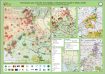
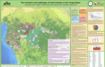
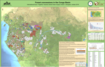
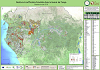
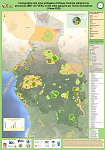
Interactive maps of ecological landscapes
These must be opened in an Adobe Reader to ensure the interactivity of the buttons.
| Administrative Area | Documents | CARPE Documents |
|---|---|---|
| Monte Alen-Mont de Cristal: | Interactive map | CARPE |
| Gamba-Mayumba-Conkouati: | Interactive map | CARPE |
| Lope-Chaillu-Louesse: | Interactive map | CARPE |
| Dja-Odzala-Minkebe (Tridom): | Interactive map | CARPE |
| Sangha Tri-National (TNS): | Interactive map | CARPE |
| Leconi-Bateke-Lefini: | Interactive map | CARPE |
| Lac Tele-Lac Tumba: | Interactive map | CARPE |
| Salonga-Lukenie-Sankuru: | Interactive map | CARPE |
| SMaringa-Lopori-Wamba: | Interactive map | CARPE |
| Maiko-Tayna-Kahuzi-Biega: | Interactive map | CARPE |
| Ituri-Epulu-Aru: | Interactive map | CARPE |
| Virunga: | Interactive map | CARPE |